

SatCON · Construction progress
SatCON tells you what stage each part of a site has reached: bare ground, graded, structures up, equipment in. It reads radar, so cloud does not hold it up, and it can find new sites that are not on the usual map providers yet.
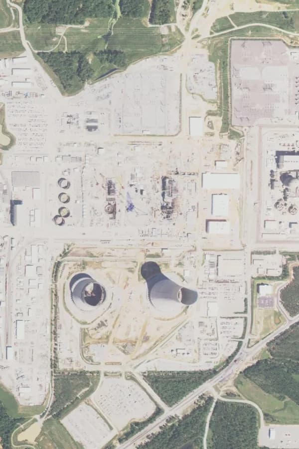 2015
2015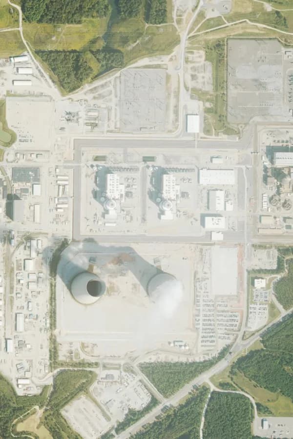 2023
2023The same patch of a power-station build in Georgia, USA, in 2015 and 2023. Imagery: USDA NAIP.
Mostly people who answer for sites they cannot visit every week.
EPC project managers
Check what subcontractors report against the site before a milestone is signed off.
Lenders and their engineers
Independent evidence of progress between site visits, ahead of each drawdown.
Developers and owners
See whether the schedule is real across several sites at once.
Government agencies
Verify progress on publicly funded projects without sending officers to every site.
Stage by zone
Each zone of the layout is marked Bare, Graded, Structures or Installed on every pass, and the site gets a percent-complete figure.
Earthworks and trenching
Detects trenching and earthworks and tracks them as they progress.
Structures and foundations
Follows the installation of structures, frames and foundations across the site.
Equipment installation
Tracks where equipment has gone in and how much of the site it covers.
Power and substation equipment
Spots transformers and switchboards as they arrive on site.
New site discovery
Finds recently built plants and facilities that are not on Google Maps yet, using imagery about five days old.
Stage is worked out from each zone's radar return. The thresholds are set for a typical site and then tuned to yours, using what your engineers see on the ground.
Bare
Untouched ground
Graded
Levelled and prepared
Structures
Frames and foundations up
Installed
Equipment or modules in place
Add the site
Upload the CAD layout or draw the boundary.
We read every radar pass
Each pass is sampled zone by zone and classified into a stage.
Track the build
A stage map for every date, and a percent-complete figure you can put in a report.